 New Zealanders, with their seemingly infinite capacity to charm, charmingly call trekking or hiking “tramping”, which constitutes something of a national pastime. Tourist brochures and government-sponsored websites alike advertise the Tongariro Alpine Crossing as the best one-day tramp in the country. Not for the faint of heart, though. It’s 19.4 kilometers (nary a water source along the way), with official estimates advising that hikers to plan on between six and eight hours, with the ominous addendum, “depending upon your condition”. You are also repeatedly reminded to pack for different kinds of weather events: you can shiver in pelting sleet and sweat in blazing rays of sun in a single day. Or you can find yourself at the peak of a dry, sandy, 10-foot-wide ridge huddling against 65 mile-per-hour winds, as happened the day after we set out on this monumental — just no other word for it — journey. Some years ago, authorities, knocking their heads together about how to adequately alarm hikers (any number have died here over the years) into packing sensibly, settled upon the seductive, but probably ineffectual name change, and the generations-marinated Tongariro Crossing became the Tongariro ALPINE Crossing.
The path goes up a valley to the saddle between Mt. Tongariro and Mt. Ngauruhoe, both active volcanos. We and our fellow hikers — a simpatico, hail-fellow-well-met, mostly international crew — are repeatedly exhorted to stick to the designated route. If you do, you pass a sign below Tongariro, the largest, offering instructions in the event that it erupts in your presence. Item one: “Move away as quickly as you are able”. I laughed, and we proceeded without bothering to read the rest.
How to convey the experience of that day? Readers may thank me for discarding my first idea, which was to snap a photo every five minutes through the entire trek and to post every one here, sequentially, with the logic being that nothing else would suffice to impart the dual sense the day gifted to us: arrested time, infinite space. Instead, I offer, in sequential order, highlights of some of the awesome moments which came to us, step by step by step, at the infinitesimal pace of human locomotion.
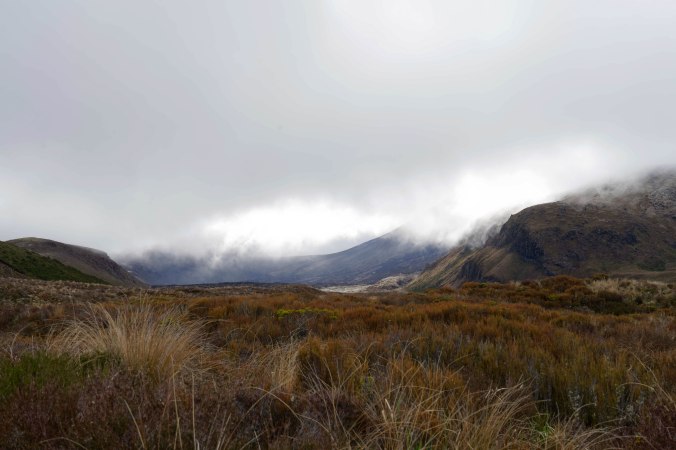
When we started, clouds draped Mount Tongariro in shades of white. Slowly, the ground cover changes: less grass, and less green, now scattered in wheat-colored clumps aside low scrub brush and lichen-covered rocks.
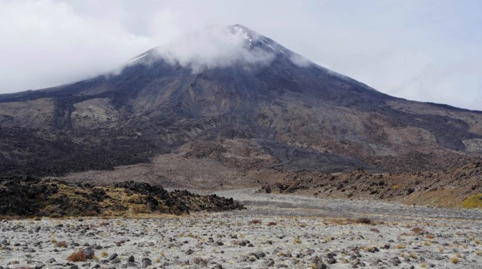
Eventually, the proportion of grass to dirt tips decisively in favor of earth, as the pure conical shape of the Tongariro crater comes into view.
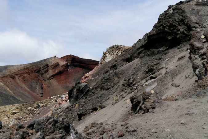
Surprise number one: Red! The Red Crater rises 6200 feet above sea level. 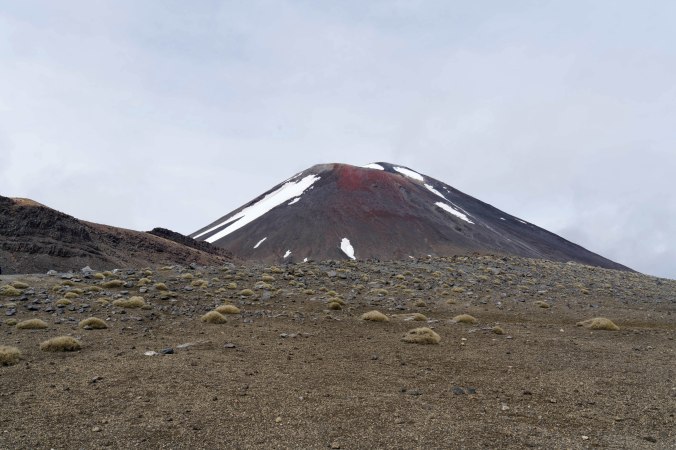
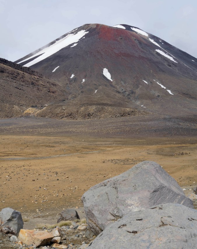
Eventually, you enter a desolate, soil and rock-strewn bowl which leads around the active, still steaming vent.

As you approach the Red Crater to circumambulate its perimeter, all flora disappear and you are left with acres liberally strewn with black, volcanic rock. The last eruption was in the late 1970s.
At the crest of the next peak, this culminates in a succession of extraordinary compositions. The pictures illustrating this post were culled from the 140+ photos I shot that day.
 Circumventing the Red Crater (you couldn’t actually ascend it) brought you into view of the vaginal-looking orifice from which all that lava spewed during its last eruption. From there, you began your multi-houred descent. Around one bend, you see this: the Emerald Lakes (at right). At left-center, in middle distance, you can just glimpse the Blue Lake, and behind it in the horizon, Lake Tapuo, which is a caldera of a different volcano, about 90 miles away.
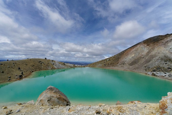
The Emerald Lakes sit at the edge of a large, grass-covered pan which resembles, a bit, the Amphitheater at the Drakensburg in South Africa. This was shot from the other end of the pan, looking back at the Red Crater.


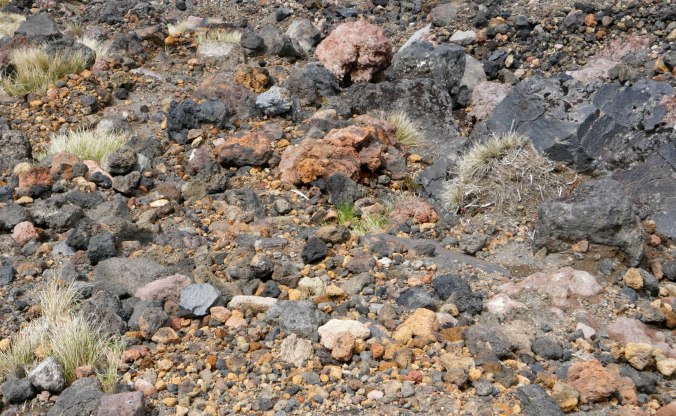
On the way down to the exit (which entailed some climbing up, too), the landscape serves up an exuberant riot of muted color.
Near the top of the descent:
And slowly, again, the proportion of volcanic rock to ground cover and grasses shifts. 
By late afternoon, you’ve spent over an hour trekking through an absurdly dense, all-embracing rain forest. Nothing to shoot except deep shadows, ferns, moss, and spreading palm leaves.
And then — you’re done.

One last shot, taken en route to our next destination, showed where we’d been, from a distance. All three of us completed the trek in seven hours, without rushing. Reveling in my inexperience and my enthusiasm, I declared the Tongariro Alpine Crossing the best hike in the world.
— Sarah

OMG Sarah…that picture near the Red Crater, too apt of a metaphor/comparison. Impressed with how adventurous you all are being!
LikeLiked by 1 person
Very enjoyable post with gorgeous photos. Thank You.
LikeLiked by 1 person
your welcome! Thanks
LikeLike